What to know before you come
- The hike is free and nobody sells a ticket to it. There is no permit and no booking; the car park charges for parking and that is the only unavoidable outlay. See is the hike free.
- The hard part is not the height, it is the ground. About 8 km round trip and roughly 350 to 500 metres of climbing depending on how you count the dips, over forest path, stone stairs, boulder field and bare rock: how hard it is.
- There is no railing at the top. The land managers left it that way deliberately, and the plateau ends: why there is no fence.
- From November to March, go with a guide or at least not alone. Visit Norway and the trail’s own operators both say so; crampons are normal winter kit: the winter hike.
- You can see Pulpit Rock without walking a step. The Lysefjord cruise passes directly below the plateau and does not land: the cruise.
- The Stavanger–Tau car ferry is gone. The Ryfylke Tunnel opened on 30 December 2019 and replaced it, so older guidebooks route you onto a boat that no longer runs: getting there.
What the guided hike from the cruise terminal covers
The flagship booking on this page. It starts at the Stavanger Cruise Terminal, drives you out to the trailhead, walks you up with a local guide and has you back in six hours — which is the only version of this day built around a ship sitting in port.
What you get
- Pickup at the Stavanger Cruise Terminal, so you are not working out a bus from Byterminalen on the morning you arrive
- The drive out through Strand municipality and back, about an hour each way
- A local guide who walks with the group rather than waiting at the bottom
- A small group, and six hours door to door — the shortest of the guided options
What it solves
- No car, and no seasonal bus outside roughly late June to mid-September: the bus season
- No car park to find, queue for or pay at: how parking works
- The six-hour arithmetic against a typical eight-to-ten-hour call: doing it from a ship
- Somebody with you who knows what the ground does when it is wet
What to know
- You are paying for the transport and the guiding, never for entry — there is no entry: the trail is free
- It is still about 8 km on your own legs and nobody carries you: how hard is it
- If you would rather be collected at your accommodation, that is a different booking: the hike with pickup
- If you do not want to walk at all, take the boat: the Lysefjord cruise
The trail, in the order you actually walk it
Six stages between the car park and the plateau, and what each one does to you. The photographs you have seen were taken with a drone or from a boat, so none of them show the middle of this list.
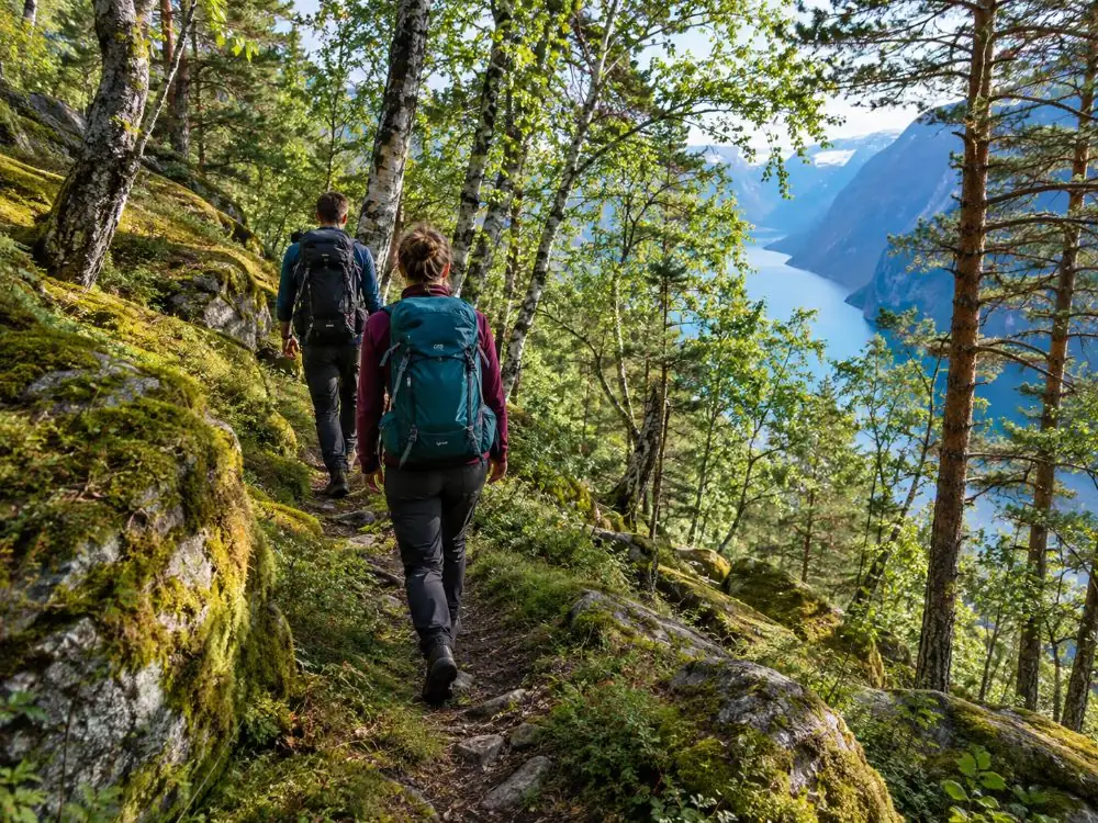
The trail starts at Preikestolen Fjellstue, about three kilometres past Jørpeland, and climbs from there. It is marked with the red painted T of the Norwegian Trekking Association and has distance posts roughly every 500 metres, so in summer you cannot get lost. What catches people out is not the navigation and not the height. It is that the surface changes under your feet five times.
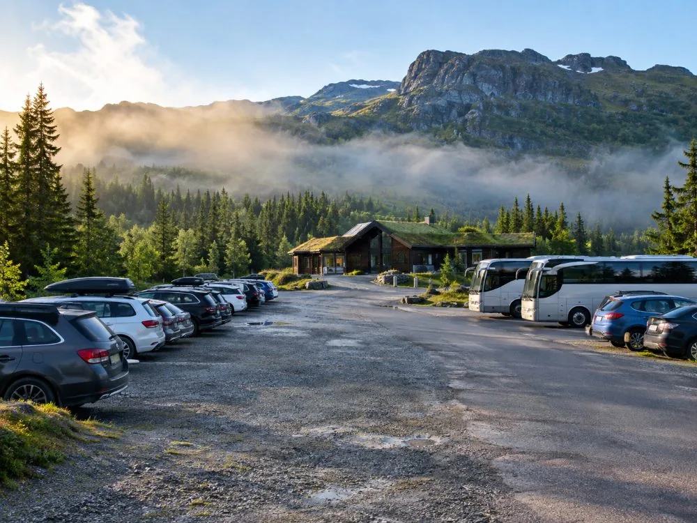
- The car park and the lodge — Preikestolen Fjellstue and Preikestolen BaseCamp sit at the trailhead, with the main lot holding about 400 cars and 20 coaches and the Moslimyrå overflow adding about 600 more. Why this matters: the staff here are the nearest thing the trail has to a closure — they will advise against walking in dangerous conditions, and you should listen to them. See how the car park works.
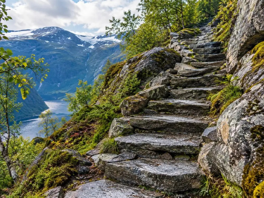
- The first climb, and the Sherpa staircase — The path leaves the lodge and goes straight up through forest, then turns into long flights of stone steps laid by Nepalese Sherpa trail builders — Norway has used them since 2005, and the big Preikestolen path project ran from 2013 to 2016 with more work from 2019. Why this matters: this is the steepest part and it comes first, before your legs are warm, which is why so many people decide in the first twenty minutes that they have made a mistake.
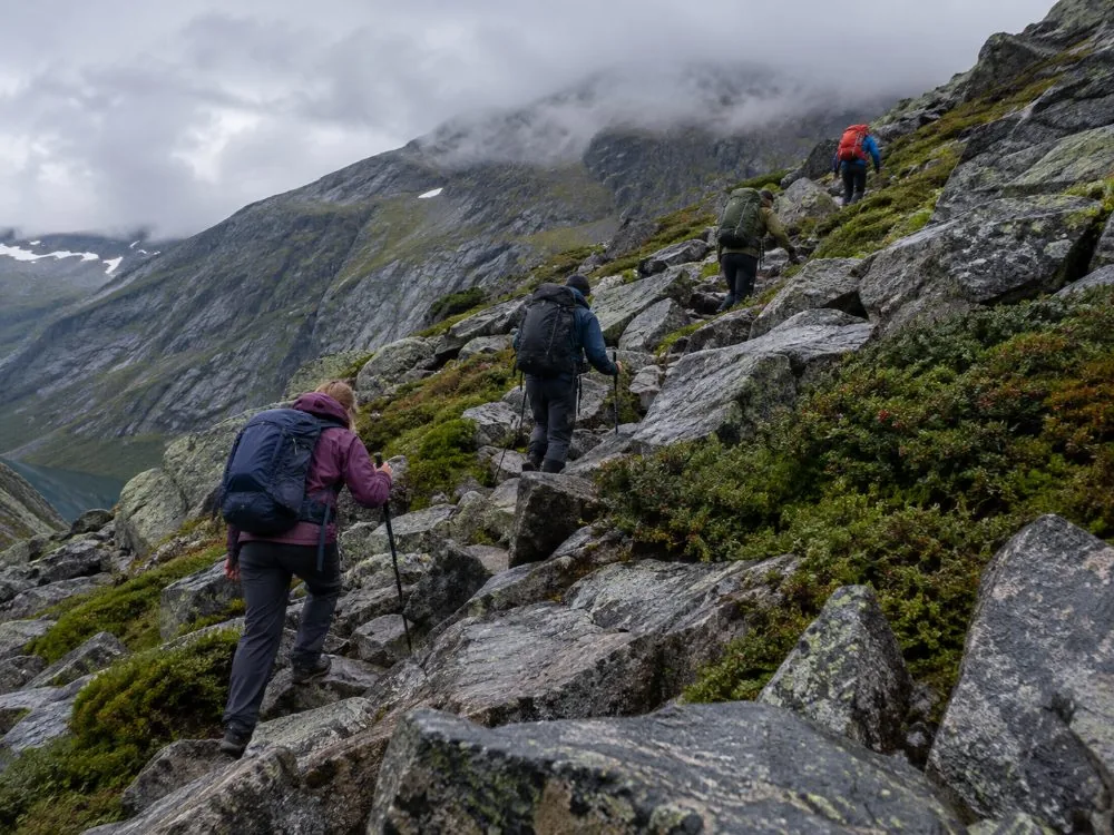
- The boulder field — The steps give out and you cross bare blocks of granite, stepping from one to the next, watching your feet rather than the view. Why this matters: this is the section nobody photographs and the one that decides whether the day is fun. Ankles turn here, and they turn far more often on the way back down, when you are tired. See what actually goes wrong.
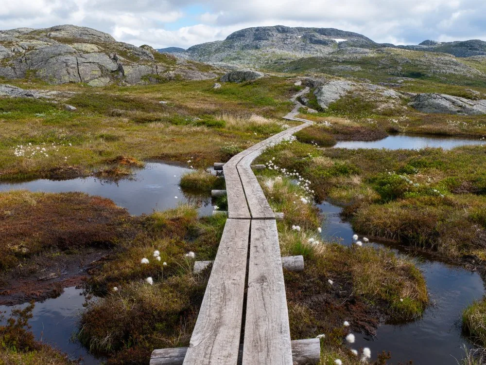
- The boardwalks over the marsh — Wooden walkways carry you across wet ground and shallow bog on the flatter middle section. Why this matters: they are the easiest walking of the whole route and the reason the trail survives 350,000 pairs of boots a year, but wet planks are slick, and this is where the trail dips as well as climbs, which is why the elevation figure is quoted anywhere between about 330 and 500 metres.
- The traverse along the fjord edge — The last stretch runs over open rock with the Lysefjord opening up 600 metres below on your left, narrow in places, exposed in others. Why this matters: this is where the drop becomes real for most people, well before the plateau, and where anyone unhappy with heights should turn round without embarrassment.
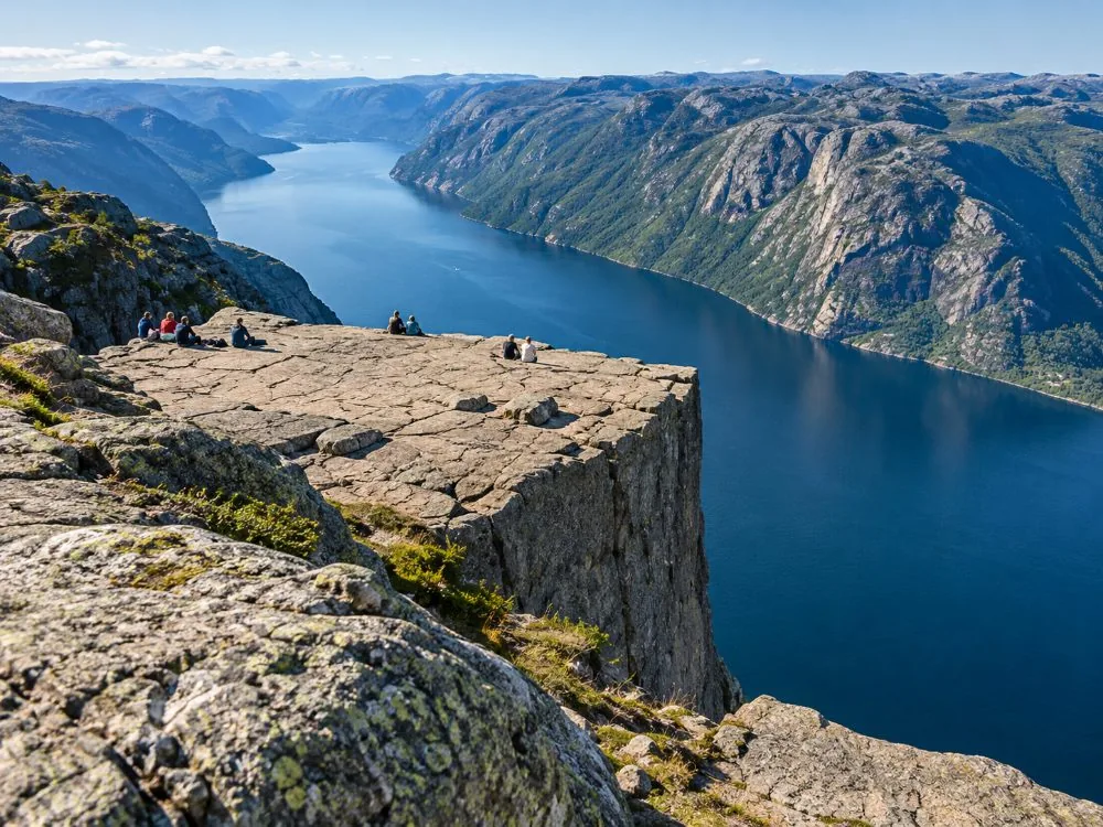
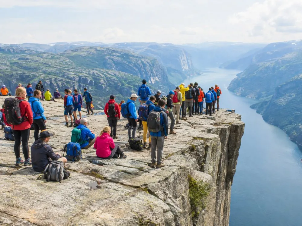
- The plateau — About 25 by 25 metres of almost flat granite, with a gap half a metre wide and several metres deep running across it, bolted and monitored since around 1930. Why this matters: there is no railing, no fence and no barrier, by deliberate choice of the land managers, and a fall from here is around 250 metres. See there is no fence and the crack in the rock.
Allow 4 to 5 hours for the round trip including time on top; fit walkers do it in 3 to 4, and I would not plan on 2 whatever you have read. The stage-by-stage version, with what the surface is doing at each point, is on the trail page, and the honest timings are on how long it takes.
Sorting the day out, in four steps
Work out if you need to book anything at all
If you have a car and it is July, you need nothing at all: drive, park, walk. If you have no car, or it is February, or your ship leaves at five, the booking is doing real work for you. Both cases are laid out on every way out of Stavanger.
Settle the transport before the tour
Highway 13 through the Ryfylke Tunnel from Stavanger takes about 45 to 60 minutes. The seasonal bus runs from Byterminalen, twice on a morning in March and April and up to nine times a day from around 20 June to around 13 September, and its tickets are sold online in advance rather than on board: getting there and the bus.
Pick the format that matches your day, not the shortest one
A day in port, a lie-in, bad knees, small children, deep winter and a wish to avoid the crowds all point at different bookings, and two of the six involve no hiking or a longer walk than the main trail. The decision table is on which one to choose.
Read the trail and pack for the weather you get
Stavanger is oceanic: around 1,310 mm of rain a year across about 162 rainy days, so plan for wet rock rather than hope for a view. Above-ankle waterproof boots, windproof layers, a phone and a headlamp: what to bring and what to wear.
The guided hike from the cruise terminal, date by date
Live dates for the flagship option: pickup at the Stavanger Cruise Terminal, the drive out, a local guide on the trail and six hours door to door. If you are staying in town rather than arriving by ship, or you would rather not hike, the comparison below sends you somewhere better.
Boat, guided hike, or picked up at your door?
Three different situations rather than three versions of the same day. The cruise is for people who want to see the cliff and not climb it. The guided hike from the terminal is built around a ship in port. The pickup version is for anyone staying in Stavanger who would like the morning to start at the hotel door.
| Stavanger: Electric Fjord Cruise to Lysefjord & Preikestolen | Our pickStavanger: Preikestolen (Pulpit Rock) Hike with Local Guide | From Stavanger: Pulpit Rock Guided Hike with Pickup | |
|---|---|---|---|
| Where it starts | Strandkaien, in Vågen | The Stavanger Cruise Terminal | Your accommodation in Stavanger |
| Duration | 3 hrs 30 | 6 hrs door to door | 7 hrs door to door |
| Walking | None at all | About 8 km, 4 to 5 hours | A quieter route rather than the main path |
| What you see | Pulpit Rock from directly below, 604 m down | The plateau itself, from on top | The plateau itself, with fewer people on the way |
| Guide | Audio guide, English and Norwegian | A local guide with the group | A local guide with the group |
| Group | A catamaran with panoramic windows | Small group | Small group |
| Also on board | Hengjanefossen, the Vagabond’s Cave, goats and eagles | The bus out through Strand and back | A later start than the terminal version |
| Best for | Bad knees, small children, three hours in port, February | A ship’s day in port with no margin to lose | Staying in town and wanting a lie-in |
| View → | Book this → | View → |
Photo gallery
Preikestolen in pictures
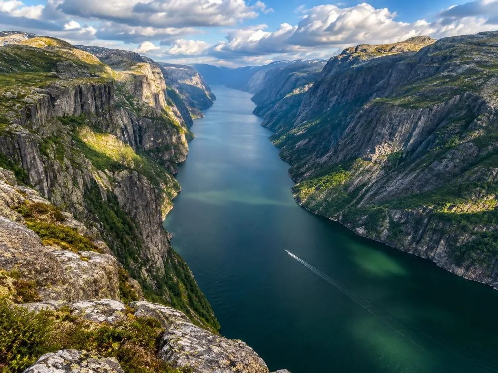
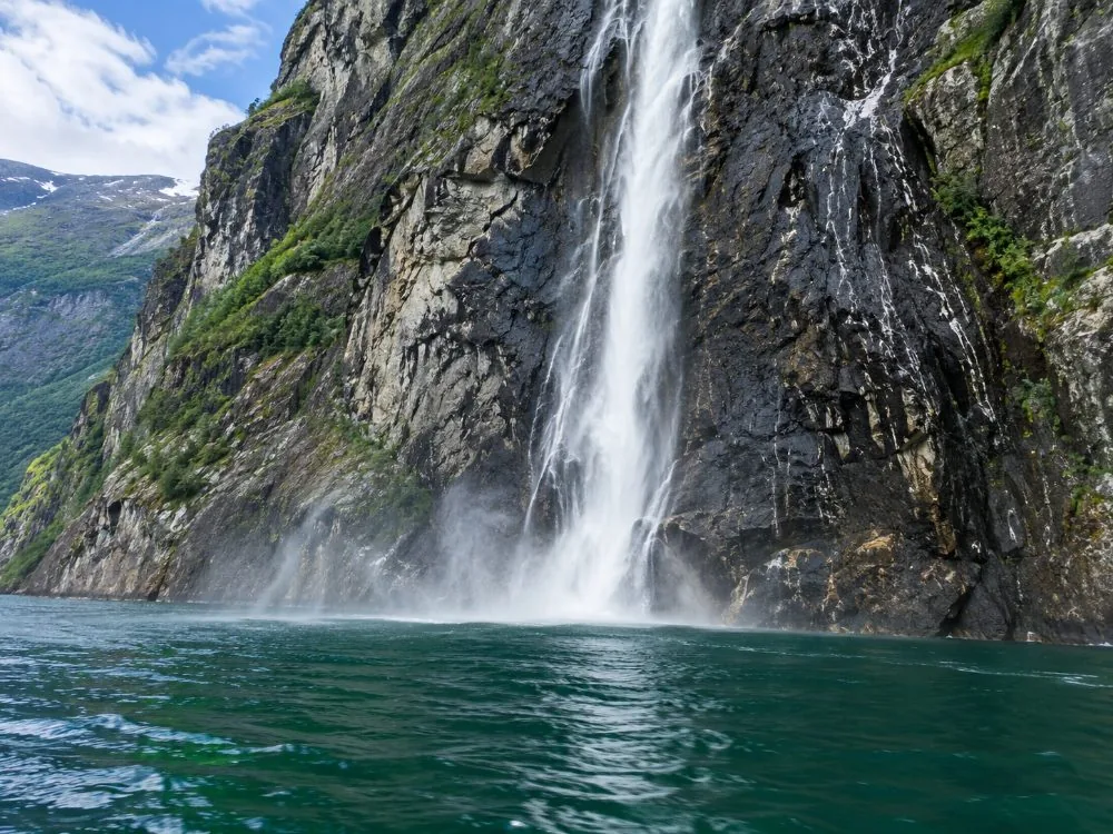
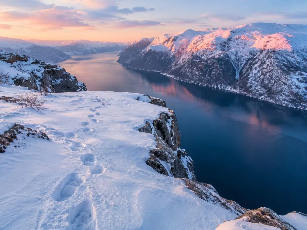
The plateau, and then the five surfaces you cross to reach it — the boulder field, the Sherpa steps, the boardwalks and the fjord edge — plus the lodge, the boat, the winter version and the queue on top.
The six bookings, side by side
Two guided hikes, the boat that does not land, the boat and the hike together, a back-country route with eight people on it, and the winter version with crampons. Our page-by-page reviews are on the reviews page, and the decision is on which one to choose.
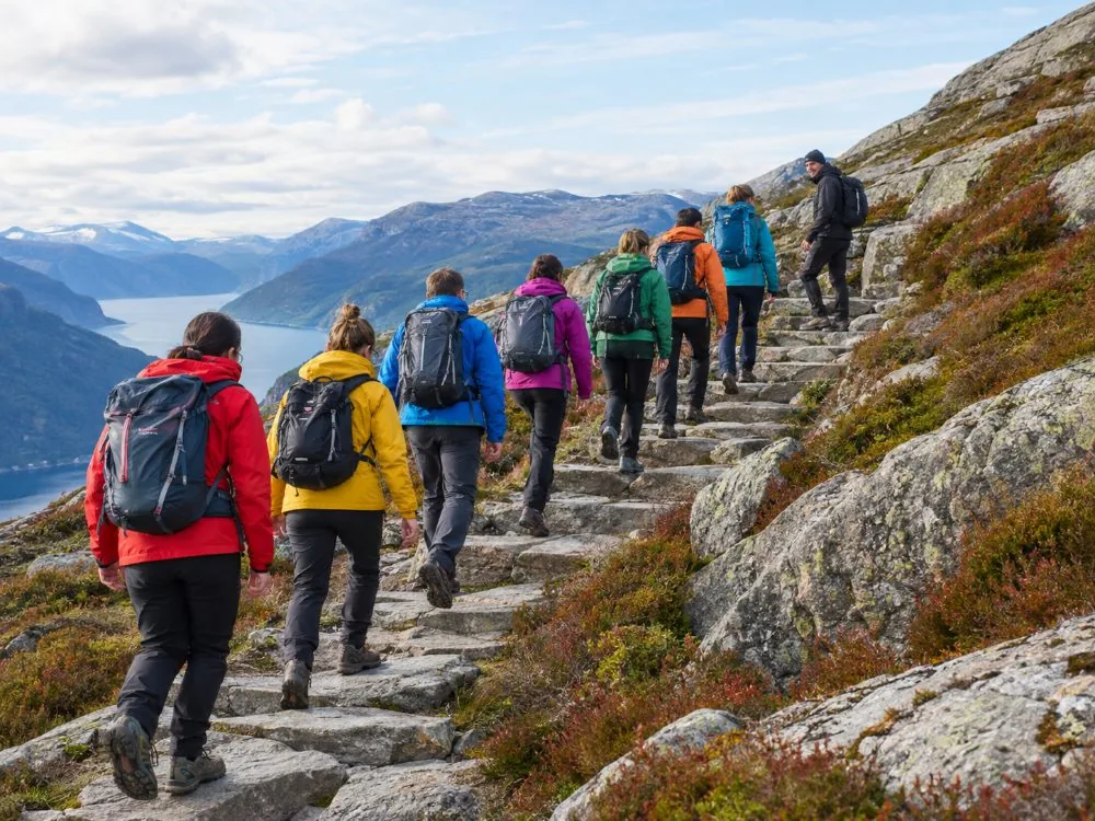 From the cruise terminal
Stavanger: Preikestolen (Pulpit Rock) Hike with Local Guide
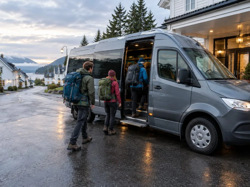 Picked up at your door
From Stavanger: Pulpit Rock Guided Hike with Pickup
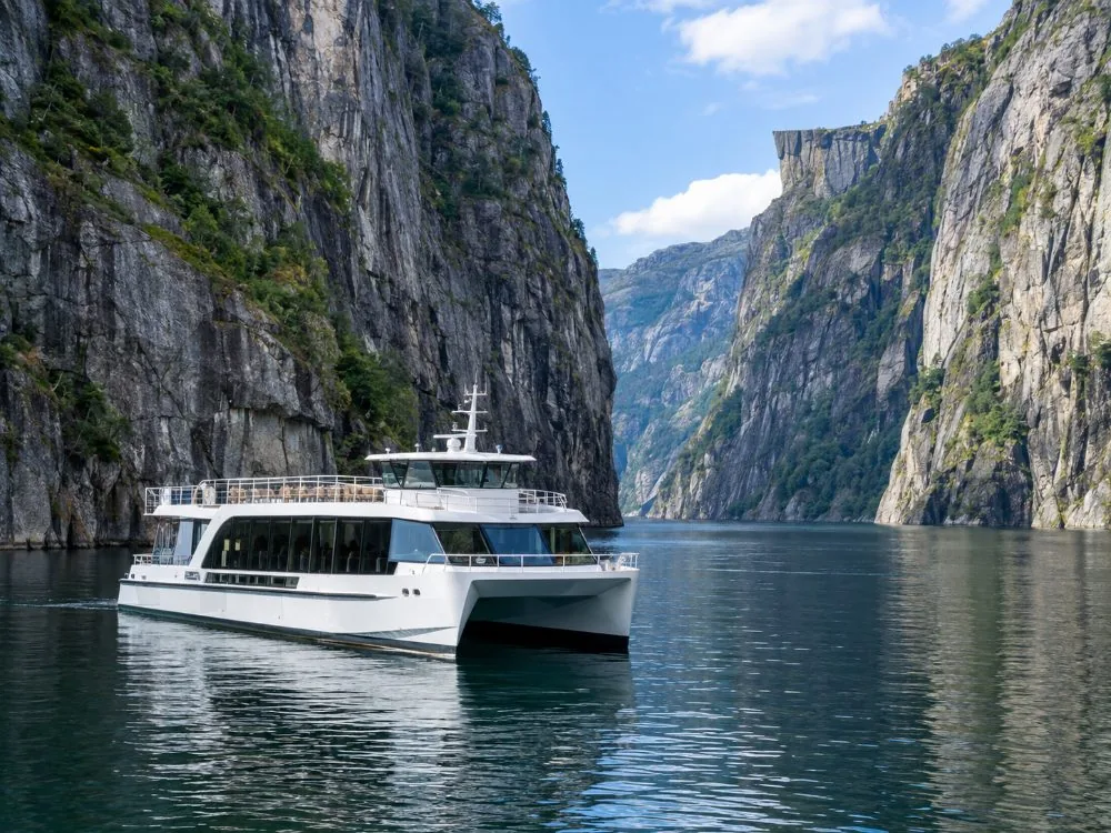 No hiking at all
Stavanger: Electric Fjord Cruise to Lysefjord & Preikestolen
 Boat and boots
Stavanger: Lysefjorden Cruise and Preikestolen Hike
 8 people maximum
Stavanger/Sandnes: Preikestolen Guided Hidden Nature Hike
 Off-season, with a guide
Lysefjorden Cruise & Preikestolen Guided Hike — Winter
What people who went say
Taken from the live GetYourGuide reviews of the six products compared here, first names as given. I have not tidied up the ones that are lukewarm.
Punctual, comfortable transport and a friendly local guide, and a beautiful hike.
A unique experience — the guide, Syria, took us on an exceptional route through the forest.
The 650-metre elevation difference should not be underestimated, but it is doable.
Off the busy track. We met only three other people on the way.
The electric boat was impressive and almost silent.
The scenery is great and the guide was friendly, but the timings felt tight.
Ratings and review counts are the live GetYourGuide figures from the operators. Read our full reviews ›
Before you book
The four things people ask me in Jørpeland, with the short answer to each.
Is it worth it if the forecast is bad?
Sometimes. The plateau is often in cloud and I will not promise you a view; what I can say is that the walk is the same walk in rain and the rock is a great deal more slippery. If you have one day and it is pouring, the boat is the better use of it. See hiking it in the rain and the weather.
Do you need a guide?
Not in summer. The trail is marked with red Ts and distance posts and you will be sharing it with a few thousand people. From roughly November to March it is a different question: snow hides the cracks and streams, the rock ices, the daylight is short, and both Visit Norway and the trail’s own operators recommend a guide. See do you need a guide.
Can children do it?
Plenty do, and plenty of families turn back half way, which is the right decision and not a failure. The plateau has no railing, so a child who runs is a problem; and nobody should take a child under five up in winter conditions. See going with children.
Is it doable on a day in port?
About an hour out, 4 to 5 hours walking and an hour back, so six hours minimum against a typical eight-to-ten-hour call. It fits, with no margin, and a missed bus is a missed ship — which is exactly why the flagship tour starts at the terminal. The arithmetic is on the cruise-ship page.
Those dates don’t work?
Browse the other Preikestolen hikes and Lysefjord cruises running from Stavanger, and pick the day that suits you — instant confirmation.
Preikestolen, explained by someone who lives below it
Preikestolen is a flat granite plateau, roughly 25 by 25 metres, standing 604 metres above the Lysefjord in Strand, Rogaland, and reached by a free, unguided public trail of about 8 km round trip that takes an average walker 4 to 5 hours. I grew up in Jørpeland, three kilometres down the road from the car park, and I still live there. When I was small this was a Sunday walk local families did in borrowed boots. Roughly 350,000 people a year come up it now, and most of what goes wrong for them comes from one misunderstanding.
The hard part is not the height
People arrive expecting a viewpoint and find a mountain walk. That is the whole of it. The climbing is somewhere between about 350 and 500 metres depending on how you count the dips, and the difficulty lives in the surface rather than the gradient: forest path, stone steps, a field of bare granite blocks you cross one at a time, boardwalks over marsh, then open rock along the fjord edge. Four to five hours of that. The photographs you have seen were taken from a drone or from a boat, so they show the plateau and none of the middle. Most of the steps were laid by Nepalese Sherpa trail builders, on this path largely between 2013 and 2016; they made the route durable rather than short. Read how hard it is before you decide, not after.
Nobody sells a ticket to this
There is no gate, no permit, no time slot and nobody taking your name. The trail never formally closes; the nearest thing to a closure is the staff at the car park advising against walking in bad conditions, and you should take that advice. So anything sold with Preikestolen in the title is selling one of three other things. The ride, because the trailhead is about an hour outside Stavanger and there is no practical way to reach it without wheels. The guide, optional in summer and a different matter in winter. Or the boat, which looks up at the cliff from 604 metres below and never lands. The long version is on what the day costs.
Getting here, and the ferry that no longer exists
From Stavanger it is Highway 13 through the Ryfylke Tunnel, off at Solbakk, then road 523 to Jørpeland: 45 to 60 minutes. Worth saying loudly, because I still meet people at the quay in town looking for it: the Stavanger–Tau car ferry closed when the tunnel opened on 30 December 2019, so guidebooks that route you onto it are out of date. Without a car there is a seasonal bus from Byterminalen, up to nine a day from around 20 June to around 13 September and only two morning departures in March and April, with tickets sold online rather than on board. Outside those months there is effectively no bus, which is when a booked tour stops being a convenience: getting there.
There is no railing, and that is deliberate
The plateau ends. No fence, no barrier, no chain, by choice of the land managers, who would rather the place stayed as it is. A fall from the edge is around 250 metres and is not survivable. The first reported tourist fatality is dated October 2013, and on 3 June 2024 a Norwegian man hiking alone fell roughly 150 to 200 metres from the summit area. There is no complete public count of deaths here, partly because Norwegian media does not report suspected suicides, so I will not give you a number. I will say that hikers have to be rescued every year, that tired legs come unstuck on the way down, and that the emergency number in Norway is 113. See how safe it is.
The crack, without the drama
A gap about half a metre wide and several metres deep runs across the plateau, watched with bolts since around 1930. In May 2017 the Geological Survey of Norway measured it 2 to 3 mm wider, the first detected movement in 22 years, and said explicitly that it was not panicking. The current assessment is that there is no foreseeable safety risk and that nobody alive should expect it to fall. The shape itself came from the end of the last ice age, roughly 10,000 years ago, when frost levered angular blocks out of a wall the glacier had steepened. The crack has its own page, because it is the question I am asked most.
Winter is a different mountain
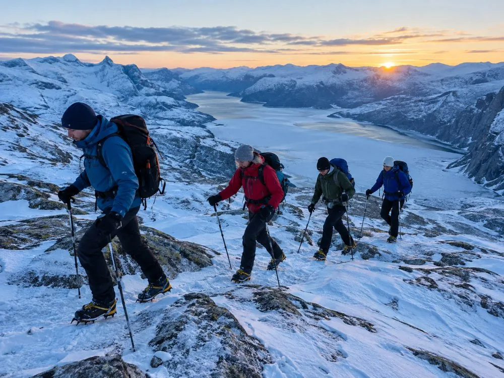
From roughly November to March, go with a guide or at least not alone. Visit Norway and the trail’s own operators say the same. Snow fills the gaps between the boulders and hides the streams, the rock ices, and the daylight is short enough that a slow group finishes in the dark. Crampons are normal kit, and the guided winter option provides them when the ice requires them: the winter hike.
If you are not going to walk it
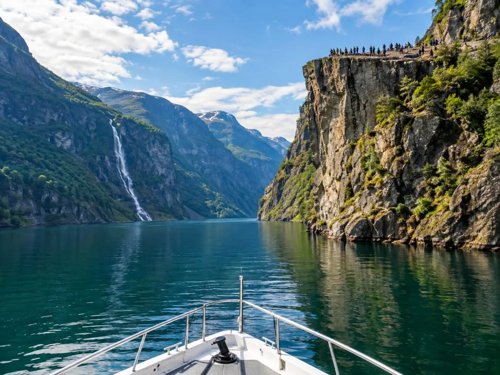
The Lysefjord cruise leaves Strandkaien on a fully electric catamaran, passes Hengjanefossen and the Vagabond’s Cave, and looks up at the plateau from directly below in 3 hrs 30 with no walking at all: the cruise.
What I would tell someone coming once
Come in September if you can choose: the trail is still in good condition and the crowds have gone home. Start early, tell someone where you are going, and take the forecast seriously — Stavanger gets around 1,310 mm of rain across about 162 rainy days a year, and the plateau is often in cloud. Wear boots above the ankle. Turn back if it is going badly. And at the top, sit down a few metres from the edge and stay a while, because everyone I watch up there spends four hours walking and eight minutes looking.
Frequently asked questions
Do you need a ticket to hike Preikestolen?
No. The trail is free, open, unguided and unstaffed, with no gate, no permit, no time slot and no opening hours, and roughly 350,000 people a year walk it for nothing. The car park charges for parking, and that is the only outlay you cannot avoid. See is the hike free.
How long does the Preikestolen hike take?
About 8 km round trip and 4 to 5 hours for an average walker, including time on the plateau. Fit walkers do it in 3 to 4. Anyone promising you 2 hours has not carried a tired seven-year-old down the boulder field: how long it takes.
How high is Preikestolen?
The plateau stands 604 metres, or 1,982 feet, above the Lysefjord, and measures roughly 25 by 25 metres. A fall from it is around 250 metres. See how high it is.
Is there a railing or a fence at the top?
No. There is no railing, fence or barrier of any kind, and that is a deliberate decision by the land managers to keep the site as it is rather than an oversight. The plateau ends: there is no fence.
How hard is the hike, really?
Harder than the photographs suggest, and not because of the height. It is roughly 350 to 500 metres of climbing depending on how you count the dips, over forest path, stone stairs, a boulder field, boardwalks and bare rock. People arrive expecting a viewpoint and find a mountain walk: how hard is it.
Do you need a guide for Preikestolen?
Optional in summer, when the trail is marked with the red T of the Norwegian Trekking Association and busy all day. From roughly November to March, both Visit Norway and the trail’s own operators recommend going with a guide, or at least not alone: snow hides the cracks and streams, the rock ices and the daylight is short. See do you need a guide and the winter hike.
How do you get from Stavanger to the trailhead?
By car it is Highway 13 through the Ryfylke Tunnel, exit at Solbakk, then road 523 to Jørpeland and the signs: about 45 to 60 minutes. The Stavanger–Tau car ferry that older guidebooks send you to closed when the tunnel opened on 30 December 2019. In season there is a bus from Byterminalen, booked online in advance: getting there and the bus and shuttle.
Can you see Pulpit Rock without hiking?
Yes, from the water. The Lysefjord cruise from Strandkaien passes 604 metres directly below the plateau, along with the Hengjanefossen waterfall and the Vagabond’s Cave, and takes 3 hrs 30. It does not land, so you do not get onto the plateau from the boat: the Lysefjord cruise.
Is the crack in the plateau dangerous?
A gap about half a metre wide and several metres deep runs across the plateau and has been monitored with bolts since around 1930. In May 2017 the Geological Survey of Norway measured it 2 to 3 mm wider, the first detected movement in 22 years, and said plainly that it was not panicking. Current assessment: no foreseeable safety risk, and no expectation of it falling in anyone’s lifetime. See the crack.
Has anyone fallen from Preikestolen?
Yes. There is no complete public count, partly because Norwegian media does not report suspected suicides. The first reported tourist fatality is dated October 2013, and on 3 June 2024 a Norwegian man hiking alone fell roughly 150 to 200 metres from the summit area. Hikers also have to be rescued every year. See has anyone fallen and how safe is it.
When is the best time to hike Preikestolen?
The reliably snow-free season runs from roughly May or June to September. June to August is the crowded stretch; September is much quieter with the trail still in good condition. See the best time to visit and missing the crowds.
Which film was shot on Preikestolen?
Mission: Impossible – Fallout. The climbing and hanging climax was filmed on the plateau between 2 and 9 November 2017, with about 140 crew and roughly 120 tonnes of equipment flown in by helicopter because nothing can land up there. Harry Potter was not filmed here: films shot here and the Harry Potter question.
Why is it called Preikestolen?
The name means the pulpit, or the preacher’s chair, and was coined around 1900 by Stavanger Turistforening, the local trekking association, originally spelled Prekestolen. In the local dialect it is Hyvlatånnå, roughly the plane blade, after the shape of a carpenter’s plane iron. See why it is called Pulpit Rock.
Still have a question? Write to us at [email protected]